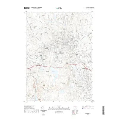
2021 Map of Fitchburg
USGS Topo · Published 2021About this map
Fitchburg State University sits at the heart of an urban landscape defined by the North Nashua River, which carves through the industrial and residential corridors of Fitchburg and Leominster. This 2021 survey illustrates a mature New England cityscape where densely settled neighborhoods like South Fitchburg and West Leominster contrast with the rugged, reservoir-dotted elevations to the west. Significant local history is preserved in numerous burial grounds, including Saint Bernards Cem and the West Street Cem, alongside landmarks such as Redemption Rock. The map reveals the intricate water management system that sustained the region's growth, featuring the Falulah Reservoir, Notown Reservoir, and Morse Reservoir. Transport infrastructure is prominently displayed, from the Wachusett Station rail connection to the Fitchburg Municipal Airport, showing how the valley's geography continues to dictate its modern layout.
Find a feature on this map
268 named features on this map. Tap any name to fly to it.
Don’t see what you’re looking for? This feature index may not catch every label — zoom into the map to look around manually.
Map Details
Editions of this 2021 Fitchburg Map
This is the sole edition of this map. No revisions or reprints were ever made.
Other maps of this area

1885 · Worcester
USGS Topo · 1:62,500

1886 · Worcester
USGS Topo · 1:62,500

1887 · Marlboro
USGS Topo · 1:62,500

1887 · Fitchburg
USGS Topo · 1:62,500

1889 · Marlboro
USGS Topo · 1:62,500

1889 · Fitchburg
USGS Topo · 1:62,500

1892 · Worcester
USGS Topo · 1:62,500

1893 · Fitchburg
USGS Topo · 1:62,500

1893 · Groton
USGS Topo · 1:62,500

1896 · Marlboro
USGS Topo · 1:62,500