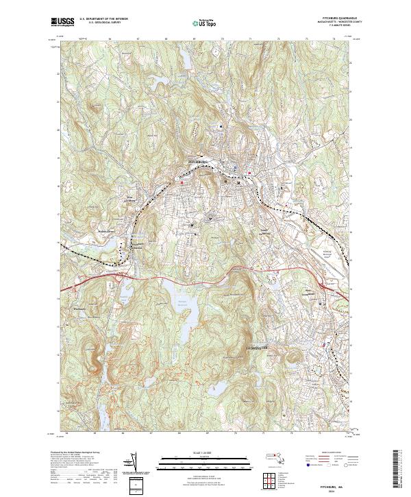
2024 Map of Fitchburg
USGS Topo · Published 2024About this map
Fitchburg and Leominster dominate this northern Worcester County landscape, where industrial development and educational hubs like Fitchburg State University are tightly integrated with the area's complex topography. The map illustrates a dense network of suburban and urban infrastructure, transitioning from the retail and transit centers of Waites Corner and Wachusett Station into the steep terrain of the Monoosnoc Hills. The North Nashua River valley serves as a primary corridor for development, framed by significant landmarks including the Fitchburg Municipal Airport and a high concentration of established burial grounds such as Saint Bernard's Cem and Forest Hill Cem. To the west, the landscape opens into protected spaces like Wachusett and Redemption Rock, where numerous reservoirs including Notown Reservoir and Sawmill Pond highlight the region's managed water resources.
Find a feature on this map
104 named features on this map. Tap any name to fly to it.
Don’t see what you’re looking for? This feature index may not catch every label — zoom into the map to look around manually.
Map Details
Editions of this 2024 Fitchburg Map
This is the sole edition of this map. No revisions or reprints were ever made.
Other maps of this area

1885 · Worcester
USGS Topo · 1:62,500

1886 · Worcester
USGS Topo · 1:62,500

1887 · Marlboro
USGS Topo · 1:62,500

1887 · Fitchburg
USGS Topo · 1:62,500

1889 · Marlboro
USGS Topo · 1:62,500

1889 · Fitchburg
USGS Topo · 1:62,500

1892 · Worcester
USGS Topo · 1:62,500

1893 · Fitchburg
USGS Topo · 1:62,500

1893 · Groton
USGS Topo · 1:62,500

1896 · Marlboro
USGS Topo · 1:62,500