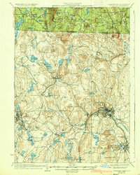
1936 Map of Fitchburg
USGS Topo · Published 1936About this map
Fitchburg and Leominster stand as the primary industrial anchors of this mid-1930s landscape, their urban footprints defined by a dense concentration of rail infrastructure. The Fitchburg Railroad and the Old Colony Railroad Fitchburg Branch converge near the Nashua River, highlighting the era's reliance on rail transport for manufacturing and commerce. Outside the city centers, the terrain transitions into a series of named elevations like Rollstone Hill and Jewell Hill, interspersed with smaller manufacturing hamlets such as Mill Village and Blackburn Village.
Find a feature on this map
123 named features on this map. Tap any name to fly to it.
Don’t see what you’re looking for? This feature index may not catch every label — zoom into the map to look around manually.
Map Details
Editions of this 1936 Fitchburg Map
2 editions found
Other maps of this area

1885 · Worcester
USGS Topo · 1:62,500

1886 · Worcester
USGS Topo · 1:62,500

1887 · Winchendon
USGS Topo · 1:62,500

1887 · Marlboro
USGS Topo · 1:62,500

1887 · Barre
USGS Topo · 1:62,500

1887 · Fitchburg
USGS Topo · 1:62,500

1889 · Marlboro
USGS Topo · 1:62,500

1889 · Fitchburg
USGS Topo · 1:62,500

1889 · Barre
USGS Topo · 1:62,500

1890 · Winchendon
USGS Topo · 1:62,500