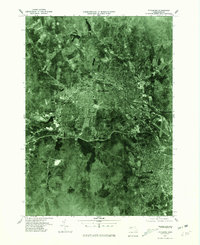
1975 Map of Fitchburg
USGS Topo · Published 1981About this map
The industrial and residential heart of northern Worcester County is captured in this orthophotograph, showcasing the densely developed center of Fitchburg during the mid-1970s. The winding path of the Nashua River cuts through the urban landscape, while the Whitman River enters from the west near the settlement of Waites Corner. This aerial perspective reveals the relationship between the city's built environment and its significant water resources, most notably the large Notown Reservoir positioned to the south.
Find a feature on this map
8 named features on this map. Tap any name to fly to it.
Don’t see what you’re looking for? This feature index may not catch every label — zoom into the map to look around manually.
Map Details
Editions of this 1975 Fitchburg Map
This is the sole edition of this map. No revisions or reprints were ever made.
Other maps of this area

1885 · Worcester
USGS Topo · 1:62,500

1886 · Worcester
USGS Topo · 1:62,500

1887 · Marlboro
USGS Topo · 1:62,500

1887 · Fitchburg
USGS Topo · 1:62,500

1889 · Marlboro
USGS Topo · 1:62,500

1889 · Fitchburg
USGS Topo · 1:62,500

1892 · Worcester
USGS Topo · 1:62,500

1893 · Fitchburg
USGS Topo · 1:62,500

1893 · Groton
USGS Topo · 1:62,500

1896 · Marlboro
USGS Topo · 1:62,500