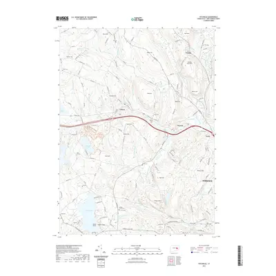
2021 Map of Fitchville
USGS Topo · Published 2021About this map
Gardner Lake and the surrounding highlands of southeastern Connecticut define the landscape of this 2021 study. The terrain is marked by a series of prominent peaks and hills, including Ayer's Mtn, Wawecus Hill, and Misery Hill, which overlook the winding Yantic River. Significant genealogical resources are documented throughout the quadrangle, with numerous burial sites such as the Bozrah Rural Cem, Gardner- Bulkeley Cem, and the Scott Hill Cem situated near established settlements like Fitchville, Gilman, and Yantic.
Find a feature on this map
142 named features on this map. Tap any name to fly to it.
Don’t see what you’re looking for? This feature index may not catch every label — zoom into the map to look around manually.
Map Details
Editions of this 2021 Fitchville Map
This is the sole edition of this map. No revisions or reprints were ever made.
Other maps of this area

1892 · New London
USGS Topo · 1:62,500

1892 · Norwich
USGS Topo · 1:62,500

1892 · Gilead
USGS Topo · 1:62,500

1893 · New London
USGS Topo · 1:62,500

1893 · Saybrook
USGS Topo · 1:62,500

1921 · New London
USGS Topo · 1:62,500

1935 · Montville
USGS Topo · 1:24,000

1939 · Montville
USGS Topo · 1:31,680
1941 · Uncasville
USGS Topo · 1:31,680

1943 · Fitchville
USGS Topo · 1:31,680