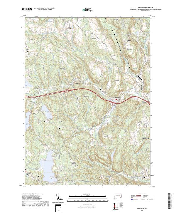
2024 Map of Fitchville
USGS Topo · Published 2024About this map
Gardner Lake and its surrounding hill country define this New London County landscape, where the Yantic River winds through the industrial and residential hamlets of Gilman, Fitchville, and Yantic. The terrain is marked by significant elevations like Misery Hill, Bear Hill, and the dramatic Bargy Ledges, reflecting the glacial legacy of eastern Connecticut. A high concentration of family and community burial grounds, such as Wightman Cem, Hough-Harris Cem, and the Gardner-Bulkeley Cem, indicates a long history of local settlement and genealogical depth.
Find a feature on this map
146 named features on this map. Tap any name to fly to it.
Don’t see what you’re looking for? This feature index may not catch every label — zoom into the map to look around manually.
Map Details
Editions of this 2024 Fitchville Map
This is the sole edition of this map. No revisions or reprints were ever made.
Other maps of this area

1892 · New London
USGS Topo · 1:62,500

1892 · Norwich
USGS Topo · 1:62,500

1892 · Gilead
USGS Topo · 1:62,500

1893 · New London
USGS Topo · 1:62,500

1893 · Saybrook
USGS Topo · 1:62,500

1921 · New London
USGS Topo · 1:62,500

1935 · Montville
USGS Topo · 1:24,000

1939 · Montville
USGS Topo · 1:31,680
1941 · Uncasville
USGS Topo · 1:31,680

1943 · Fitchville
USGS Topo · 1:31,680