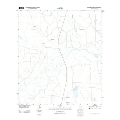
2013 Map of Fitzpatrick Hollow
USGS Topo · Published 2013About this map
The Nueces River meanders through this portion of McMullen County, defining a landscape shaped by intermittent watercourses and established ranching properties. Significant holdings such as True Ranch and Arrowhead Ranch anchor the local geography, with the latter featuring the Arrowhead Ranch Airport as a modern aviation point. The terrain is marked by the Kings Hills and the namesake Fitzpatrick Hollow, while an intricate network of drainage features like Leopard Cr and Canyon Cr feed into the river system.
Find a feature on this map
20 named features on this map. Tap any name to fly to it.
Don’t see what you’re looking for? This feature index may not catch every label — zoom into the map to look around manually.
Map Details
Editions of this 2013 Fitzpatrick Hollow Map
This is the sole edition of this map. No revisions or reprints were ever made.
Other maps of this area

1920 · Mikeska
USGS Topo · 1:125,000

1925 · Tilden No. 1
USGS Topo · 1:48,000

1925 · Simmons No. 2
USGS Topo · 1:48,000

1929 · Simmons
USGS Topo · 1:62,500

1930 · Tilden
USGS Topo · 1:62,500

1937 · Loma Alta
USGS Topo · 1:62,500

1942 · Tilden
USGS Topo · 1:62,500

1953 · Crystal City
USGS Topo · 1:250,000

1955 · Crystal City
USGS Topo · 1:250,000

1961 · Crystal City
USGS Topo · 1:250,000