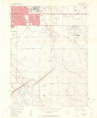
1957 Map of Fitzsimons
USGS Topo · Published 1962About this map
Fitzsimons Army Hospital and the sprawling residential blocks of Aurora anchor the northern portion of this late 1950s landscape, illustrating the rapid post-war growth of the Denver suburbs. The map captures a moment when mid-century urban expansion met massive military installations, with Lowry Air Force Base and the Naval Air Station (Buckley Field) occupying significant tracts of land. Between these hubs, the landscape remains largely open, marked by the winding paths of Toll Gate Creek and the man-made progress of the Highline Canal. To the south, the recently completed Cherry Creek Reservoir introduces a new focus for the region, complete with a maximum flood control pool and burgeoning recreational areas like the Meadow Hills Country Club. This survey preserves the exact street grid of developing neighborhoods, naming local institutions such as St Pius Tenth Sch and Peoria Sch before the area was fully built out.
Find a feature on this map
61 named features on this map. Tap any name to fly to it.
Don’t see what you’re looking for? This feature index may not catch every label — zoom into the map to look around manually.
Map Details
Editions of this 1957 Fitzsimons Map
2 editions found
Other maps of this area

1890 · East Denver
USGS Topo · 1:125,000

1935 · East Denver Nos. 3 and 4
USGS Topo · 1:48,000

1938 · Derby
USGS Topo · 1:24,000

1938 · Long Branch
USGS Topo · 1:24,000

1939 · Coal Creek
USGS Topo · 1:24,000

1940 · Englewood
USGS Topo · 1:31,680

1940 · Piney Creek
USGS Topo · 1:24,000

1940 · Derby
USGS Topo · 1:31,680

1941 · Long Branch
USGS Topo · 1:31,680

1941 · Fitzsimons
USGS Topo · 1:31,680