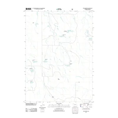
2011 Map of Five Points
USGS Topo · Published 2011About this map
Five Points sits at the heart of this northwestern Nebraska landscape, where the high plains are carved by a dense network of intermittent drainages and ranching improvements. The area is defined by its water management, featuring a high concentration of privately named stock reservoirs and dams such as the Staudenmaier Reservoir and the Wickersham Reservoir system. These features, along with named homesteads like Licket Ranch and Piper Ranch, illustrate the persistent efforts of regional ranchers to harness the seasonal flow of creeks like Cowboy Creek and Horse Creek.
Find a feature on this map
39 named features on this map. Tap any name to fly to it.
Don’t see what you’re looking for? This feature index may not catch every label — zoom into the map to look around manually.
Map Details
Editions of this 2011 Five Points Map
This is the sole edition of this map. No revisions or reprints were ever made.
Other maps of this area

1955 · Alliance
USGS Topo · 1:250,000

1957 · Alliance
USGS Topo · 1:250,000

1958 · Alliance
USGS Topo · 1:250,000

1979 · Harrison East
USGS Topo · 1:24,000

1980 · Montrose
USGS Topo · 1:24,000

1980 · Smiley Canyon
USGS Topo · 1:24,000

1980 · Five Points
USGS Topo · 1:24,000

1980 · Andrews
USGS Topo · 1:24,000
1980 · Orella
USGS Topo · 1:24,000
1980 · Roundtop
USGS Topo · 1:24,000