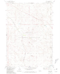
1980 Map of Orella
USGS Topo · Published 1981About this map
The Oglala National Grassland dominates this corner of Northwest Nebraska, where the arid high plains are sculpted into the Waldon Hills. This 1980 survey shows the remote settlement of Orella, positioned along the Burlington Northern railroad line which cuts a diagonal path through the prairie. The landscape is defined by the management of water and geography, featuring numerous water catchments like Agate Dam Reservoir, Board Gate Dam Res, and Meng Reservoir. Notable landforms such as Sugar Loaf Butte and Twin Butte provide sharp vertical orientation in an otherwise undulating terrain. The presence of Sugar Loaf Road and the various branches of Big Cottonwood Creek illustrate the intersection of early ranching infrastructure and the natural drainage patterns of the Sioux County panhandle.
Find a feature on this map
14 named features on this map. Tap any name to fly to it.
Don’t see what you’re looking for? This feature index may not catch every label — zoom into the map to look around manually.
Map Details
Editions of this 1980 Orella Map
This is the sole edition of this map. No revisions or reprints were ever made.
Other maps of this area

1896 · Oelrichs
USGS Topo · 1:125,000

1900 · Oelrichs
USGS Topo · 1:125,000

1902 · Edgemont
USGS Topo · 1:125,000

1955 · Hot Springs
USGS Topo · 1:250,000

1955 · Alliance
USGS Topo · 1:250,000

1957 · Alliance
USGS Topo · 1:250,000

1958 · Alliance
USGS Topo · 1:250,000

1980 · Horn
USGS Topo · 1:24,000

1980 · Montrose
USGS Topo · 1:24,000

1980 · Wolf Butte
USGS Topo · 1:24,000