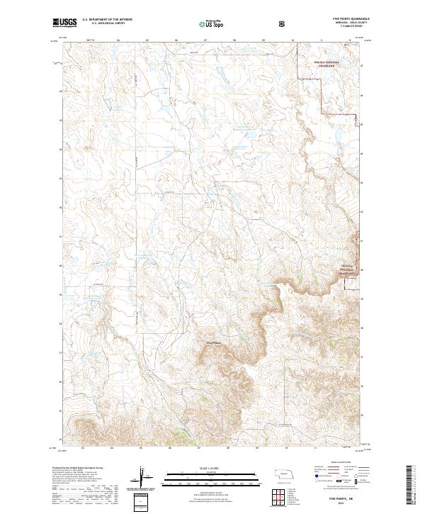
2021 Map of Five Points
USGS Topo · Published 2021About this map
Oglala National Grassland dominates this section of Sioux County, where a complex network of seasonal drainages and local reservoirs defines the landscape. The namesake locality of Five Points sits at a junction of high-elevation terrain, surrounded by a series of engineered water catchments such as Eberspecher Reservoir, Wickersham Reservoir, and Staudenmaier Reservoir. These features, often bearing local family names like Serres and Coffee Reservoir, illustrate the critical importance of water management in this arid Nebraska territory. Navigational routes like Orella Rd and Martin Trail Rd cut through the dissected plateaus, while deep incisions like Bears Canyon and the winding course of Jim Cr reveal the erosive history of the plains. This survey provides a look at the interplay between modern ranching infrastructure and the protected federal lands of the northern Great Plains.
Find a feature on this map
34 named features on this map. Tap any name to fly to it.
Don’t see what you’re looking for? This feature index may not catch every label — zoom into the map to look around manually.
Map Details
Editions of this 2021 Five Points Map
This is the sole edition of this map. No revisions or reprints were ever made.
Other maps of this area

1955 · Alliance
USGS Topo · 1:250,000

1957 · Alliance
USGS Topo · 1:250,000

1958 · Alliance
USGS Topo · 1:250,000

1979 · Harrison East
USGS Topo · 1:24,000

1980 · Montrose
USGS Topo · 1:24,000

1980 · Smiley Canyon
USGS Topo · 1:24,000

1980 · Five Points
USGS Topo · 1:24,000

1980 · Andrews
USGS Topo · 1:24,000
1980 · Orella
USGS Topo · 1:24,000
1980 · Roundtop
USGS Topo · 1:24,000