
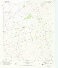
1971 Map of Five Wells Ranch SE
USGS Topo · Published 1974About this map
Magutex Oil Field and the adjacent Hutex Oil Field dominate this West Texas landscape, where the petroleum industry and cattle ranching coexist across a high plains expanse. Grounded in a 1971 field check, the survey reveals a transition from traditional livestock water sources to intensive energy production, marked by numerous drill holes and oil wells. The terrain, including the broad Prairie Dog Flat, is peppered with an extensive network of named windmills that serve as vital landmarks and genealogical touchstones for the Andrews County ranching community. These features, ranging from the uniquely named Doodlebug Windmill and Okie Windmill to the Two Section Windmill, trace the layout of family-run operations and historical fence lines in a region where water management was as critical as the oil being extracted from beneath the surface.
Find a feature on this map
24 named features on this map. Tap any name to fly to it.
Don’t see what you’re looking for? This feature index may not catch every label — zoom into the map to look around manually.
Map Details
Editions of this 1971 Five Wells Ranch SE Map
This is the sole edition of this map. No revisions or reprints were ever made.
Other maps of this area

1954 · Hobbs
USGS Topo · 1:250,000

1958 · Hobbs
USGS Topo · 1:250,000

1966 · Mabee Ranch
USGS Topo · 1:24,000

1966 · Scharbauer Ranch
USGS Topo · 1:24,000

1966 · Bird Ranch
USGS Topo · 1:24,000

1968 · Baird Lake
USGS Topo · 1:24,000

1968 · Gardendale NW
USGS Topo · 1:24,000

1971 · Five Wells Ranch NW
USGS Topo · 1:24,000

1971 · Five Wells Ranch
USGS Topo · 1:24,000
1971 · Five Wells Ranch SW
USGS Topo · 1:24,000