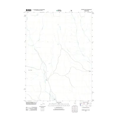
2012 Map of Fivemile Gulch
USGS Topo · Published 2012About this map
Old Winecup Ranch and the Rancho Grande sit within this sparsely settled landscape along the winding course of Goose Creek. The terrain is defined by a network of drainage systems, including Trout Creek, Piney Creek, and Bottom Creek, which cut through the high desert environment of Elko County. Water sources are critical identifiers here, with numerous named points such as Whitey Davis Spring, Buck Springs, and Sand Spring providing essential orientation in a region dominated by sagebrush and drainage basins. Sugar Loaf Peak rises as a prominent landmark above the surrounding flats and the eponymous Fivemile Gulch. Human infrastructure is light, represented primarily by the unpaved corridor of Goose Creek Rd, which tracks the primary waterway through the quadrangle.
Find a feature on this map
16 named features on this map. Tap any name to fly to it.
Don’t see what you’re looking for? This feature index may not catch every label — zoom into the map to look around manually.
Map Details
Editions of this 2012 Fivemile Gulch Map
This is the sole edition of this map. No revisions or reprints were ever made.
Other maps of this area

1955 · Twin Falls
USGS Topo · 1:250,000

1955 · Wells
USGS Topo · 1:250,000

1958 · Wells
USGS Topo · 1:250,000

1958 · Twin Falls
USGS Topo · 1:250,000

1961 · Wells
USGS Topo · 1:250,000

1961 · Gollaher Mountain
USGS Topo · 1:62,500

1961 · Goose Creek
USGS Topo · 1:62,500

1977 · Timber Butte
USGS Topo · 1:24,000

1977 · Mahogany Butte
USGS Topo · 1:24,000
1977 · Ibex Peak
USGS Topo · 1:24,000