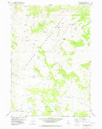
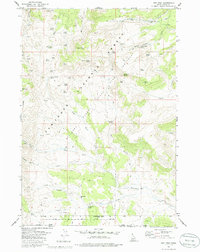
1977 Map of Ibex Peak
USGS Topo · Published 1978About this map
The tri-state junction of Idaho, Nevada, and Utah defines the southern reach of this 1970s survey, where high desert peaks meet a network of seasonal springs and canyon forks. Remote landmarks like Ibex Peak and Joes Mountain overlook a landscape traditionally used for ranching and resource extraction, evidenced by the Worthington Mine and family-named outposts such as Wards Corral and Emery Ranch. The map captures the complex administrative boundaries of the Sawtooth National Forest and Minidoka National Forest, alongside the State Bird Sanctuary.
Find a feature on this map
95 named features on this map. Tap any name to fly to it.
Don’t see what you’re looking for? This feature index may not catch every label — zoom into the map to look around manually.
Map Details
Editions of this 1977 Ibex Peak Map
2 editions found
Other maps of this area

1954 · Pocatello
USGS Topo · 1:250,000

1954 · Brigham City
USGS Topo · 1:250,000

1955 · Twin Falls
USGS Topo · 1:250,000

1955 · Wells
USGS Topo · 1:250,000

1958 · Wells
USGS Topo · 1:250,000

1958 · Twin Falls
USGS Topo · 1:250,000

1958 · Pocatello
USGS Topo · 1:250,000

1958 · Brigham City
USGS Topo · 1:250,000
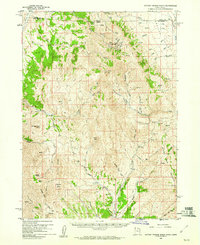
1959 · Cotton Thomas Basin
USGS Topo · 1:62,500

1961 · Wells
USGS Topo · 1:250,000