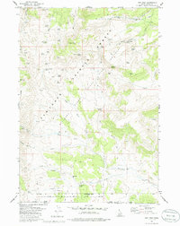
1977 Map of Ibex Peak
USGS Topo · Published 1986About this map
The high desert landscape of the Sawtooth National Forest is defined here by a dense network of mountain springs and remote cattle ranching infrastructure. At the center of this 1970s survey, Ibex Peak rises over a terrain dominated by named water sources like Hole in the Wall Spring and Chalk Spring, which sustained the area's livestock operations. Traces of human activity are concentrated around features like Wards Corral and Owens Corral, while the south reveals a transition into the Minidoka State Bird Sanctuary.
Find a feature on this map
55 named features on this map. Tap any name to fly to it.
Don’t see what you’re looking for? This feature index may not catch every label — zoom into the map to look around manually.
Map Details
Editions of this 1977 Ibex Peak Map
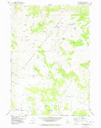
2 editions found
Other maps of this area

1954 · Pocatello
USGS Topo · 1:250,000

1954 · Brigham City
USGS Topo · 1:250,000

1955 · Twin Falls
USGS Topo · 1:250,000

1955 · Wells
USGS Topo · 1:250,000

1958 · Wells
USGS Topo · 1:250,000

1958 · Twin Falls
USGS Topo · 1:250,000

1958 · Pocatello
USGS Topo · 1:250,000

1958 · Brigham City
USGS Topo · 1:250,000

1959 · Cotton Thomas Basin
USGS Topo · 1:62,500

1961 · Wells
USGS Topo · 1:250,000