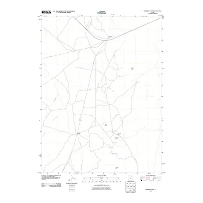
2011 Map of Fivemile Pass
USGS Topo · Published 2011About this map
Topliff sits as a central point of interest in this high-desert landscape, where the geography is defined by a series of significant mountain gaps. The map documents a corridor of transit and topographical markers, including Fivemile Pass, Sevenmile Pass, and Tenmile Pass, which suggest a historical sequence of distance-based naming along early travel routes. The presence of Railroad Bed Rd indicates the path of a former rail line that once served this region, connecting the hills to broader industrial or mining networks.
Find a feature on this map
13 named features on this map. Tap any name to fly to it.
Don’t see what you’re looking for? This feature index may not catch every label — zoom into the map to look around manually.
Map Details
Editions of this 2011 Fivemile Pass Map
This is the sole edition of this map. No revisions or reprints were ever made.
Other maps of this area

1885 · Tooele Valley
USGS Topo · 1:250,000

1915 · Fairfield
USGS Topo · 1:62,500

1917 · Fairfield
USGS Topo · 1:62,500

1918 · Stockton
USGS Topo · 1:62,500

1947 · Fivemile Pass
USGS Topo · 1:62,500

1947 · Allens Ranch
USGS Topo · 1:24,000

1947 · Boulter Peak
USGS Topo · 1:24,000

1947 · Goshen Pass
USGS Topo · 1:24,000

1949 · Allens Ranch
USGS Topo · 1:24,000

1949 · Fivemile Pass
USGS Topo · 1:24,000