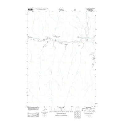
2012 Map of Flag Peak
USGS Topo · Published 2012About this map
The North Fork Shoshone River valley serves as the central artery for this part of Park County, where the transition from river bottom to high peaks is marked by a series of distinctively named geological formations. Landmarks such as Old Woman Cabin Rock, Slipper Rock, and Camel Rock overlook the canyon, while the curiously named Holy City sits tucked against the northern banks. The landscape is shaped by the intersection of recreational tourism and agricultural utility, evidenced by a string of seasonal settlements and campgrounds including Pagoda Creek Summer Homes, Wapiti Campground, and Big Game Campground. Irrigation infrastructure, critical for sustaining local ranching, is clearly visible through the paths of the Canyon Cr Ditch and the North Fork Valley Ditch. Higher elevations are dominated by landmarks like Signal Peak and Flag Peak, which rise above the complex network of drainages including Clocktower Cr and Lost Cr.
Find a feature on this map
43 named features on this map. Tap any name to fly to it.
Don’t see what you’re looking for? This feature index may not catch every label — zoom into the map to look around manually.
Map Details
Editions of this 2012 Flag Peak Map
This is the sole edition of this map. No revisions or reprints were ever made.
Other maps of this area

1893 · Ishawooa
USGS Topo · 1:125,000

1895 · Ishawooa
USGS Topo · 1:125,000

1896 · Crandall Creek
USGS Topo · 1:125,000

1899 · Crandall
USGS Topo · 1:125,000

1899 · Ishawooa
USGS Topo · 1:125,000

1949 · Pat O'Hara Mountain
USGS Topo · 1:62,500

1955 · Cody
USGS Topo · 1:250,000

1956 · Dead Indian Peak
USGS Topo · 1:62,500

1957 · Wapiti
USGS Topo · 1:62,500

1958 · Cody
USGS Topo · 1:250,000