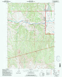
1991 Map of Flag Peak
USGS Topo · Published 1997About this map
The North Fork Shoshone River carves through the heart of the Shoshone National Forest in this late-twentieth-century study, where the highway corridor serves as the primary artery for local ranching and recreation. The settlement at Wapiti and several established outposts like Circle H Ranch, Grizzly Ranch, and Rimrock Ranch line the river valley, providing a human footprint at the edge of the wilderness.
Find a feature on this map
42 named features on this map. Tap any name to fly to it.
Don’t see what you’re looking for? This feature index may not catch every label — zoom into the map to look around manually.
Map Details
Editions of this 1991 Flag Peak Map
This is the sole edition of this map. No revisions or reprints were ever made.
Other maps of this area

1893 · Ishawooa
USGS Topo · 1:125,000

1895 · Ishawooa
USGS Topo · 1:125,000

1896 · Crandall Creek
USGS Topo · 1:125,000

1899 · Crandall
USGS Topo · 1:125,000

1899 · Ishawooa
USGS Topo · 1:125,000

1949 · Pat O'Hara Mountain
USGS Topo · 1:62,500

1955 · Cody
USGS Topo · 1:250,000

1956 · Dead Indian Peak
USGS Topo · 1:62,500

1957 · Wapiti
USGS Topo · 1:62,500

1958 · Cody
USGS Topo · 1:250,000