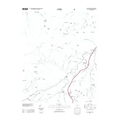
2013 Map of Flag Pond
USGS Topo · Published 2013About this map
Ernestville and Flag Pond anchor this topographic study of the Appalachian landscape along the Tennessee-North Carolina border. The area is defined by a dense network of watercourses, including S Indian Cr and the Devil Fork, which have shaped the settlement patterns in these deep valleys. Local industry and subsistence are evidenced by landmarks like Harris Mill and Phillips Mill, while the high country features notable peaks such as Sampson Mountain and Rich Mountain.
Find a feature on this map
113 named features on this map. Tap any name to fly to it.
Don’t see what you’re looking for? This feature index may not catch every label — zoom into the map to look around manually.
Map Details
Editions of this 2013 Flag Pond Map
This is the sole edition of this map. No revisions or reprints were ever made.
Other maps of this area

1891 · Roan Mountain
USGS Topo · 1:125,000

1892 · Greeneville
USGS Topo · 1:125,000

1894 · Asheville
USGS Topo · 1:125,000

1894 · Roan Mountain
USGS Topo · 1:125,000

1896 · Greeneville
USGS Topo · 1:125,000

1900 · Mount Mitchell
USGS Topo · 1:125,000

1901 · Asheville
USGS Topo · 1:125,000

1902 · Mount Mitchell
USGS Topo · 1:125,000

1904 · Roan Mountain
USGS Topo · 1:125,000

1904 · Greeneville
USGS Topo · 1:125,000