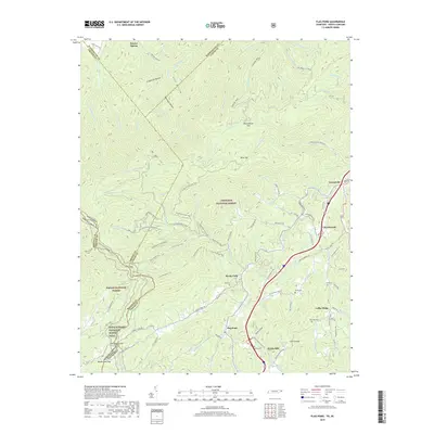
2019 Map of Flag Pond
USGS Topo · Published 2019About this map
South Indian Creek carves a path through the southern Appalachian landscape along the border of Tennessee and North Carolina, anchoring a region defined by high ridges and narrow hollows. In this part of the Cherokee National Forest and Pisgah National Forest, the Appalachian National Scenic Trail winds across the high ground of Green Ridge near Flint Gap. The settlement pattern follows the water, with communities like Flag Pond and Ernestville situated along the valley floors.
Find a feature on this map
117 named features on this map. Tap any name to fly to it.
Don’t see what you’re looking for? This feature index may not catch every label — zoom into the map to look around manually.
Map Details
Editions of this 2019 Flag Pond Map
This is the sole edition of this map. No revisions or reprints were ever made.
Other maps of this area

1891 · Roan Mountain
USGS Topo · 1:125,000

1892 · Greeneville
USGS Topo · 1:125,000

1894 · Asheville
USGS Topo · 1:125,000

1894 · Roan Mountain
USGS Topo · 1:125,000

1896 · Greeneville
USGS Topo · 1:125,000

1900 · Mount Mitchell
USGS Topo · 1:125,000

1901 · Asheville
USGS Topo · 1:125,000

1902 · Mount Mitchell
USGS Topo · 1:125,000

1904 · Roan Mountain
USGS Topo · 1:125,000

1904 · Greeneville
USGS Topo · 1:125,000