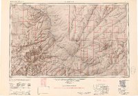
1947 Map of Flagstaff
USGS Topo · Published 1951About this map
Humphreys Peak 12611 and the high volcanic peaks of the San Francisco Mountain range dominate the western half of this 1947 survey, where the Atchison Topeka and Santa Fe railroad and Highway 66 thread through the city of Flagstaff. To the east, the landscape descends into the Painted Desert and the Moenkopi Plateau, revealing a settlement pattern defined by traditional Hopi villages like Oraibi and Walpi and the early Navajo Indian Reservation. The presence of the Meteor Crater and Sunset Crater highlights the area's geological volatility, while the concentration of lakes south of Flagstaff, including Mormon Lake and Lake Mary, indicates the region's reliance on these rare high-altitude water sources for ranching and local development during the mid-century.
Find a feature on this map
108 named features on this map. Tap any name to fly to it.
Don’t see what you’re looking for? This feature index may not catch every label — zoom into the map to look around manually.
Map Details
Editions of this 1947 Flagstaff Map
2 editions found

Other maps of this area

1883 · Marsh Pass
USGS Topo · 1:250,000

1883 · Tusayan
USGS Topo · 1:250,000

1886 · St Johns
USGS Topo · 1:250,000

1886 · Tusayan
USGS Topo · 1:250,000

1886 · Fort Defiance
USGS Topo · 1:250,000

1886 · San Francisco Mtns
USGS Topo · 1:250,000

1886 · Chino
USGS Topo · 1:250,000

1886 · Echo Cliffs
USGS Topo · 1:250,000

1886 · Holbrook
USGS Topo · 1:250,000

1886 · Kaibab
USGS Topo · 1:250,000