1958 Map of Flagstaff
USGS Topo · Published 1958About this map
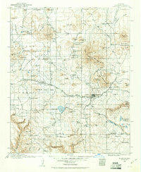
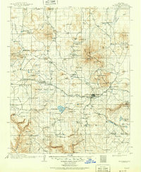
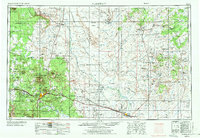
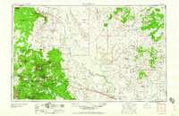
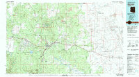
Humphreys Peak and the volcanic terrain of the San Francisco Mountains dominate the western horizon of this mid-century survey. The landscape transitions from the high-altitude forests of the Coconino National Forest down to the arid expanses of the Painted Desert and Ward Terrace. A significant portion of the sheet is dedicated to the Hopi Indian Reservation and Navajo Indian Reservation, showing the traditional mesa-top settlements such as Old Oraibi, Shongopovi, and Walpi. Modern infrastructure of the era is evident along the southern corridor, where the Atchison Topeka and Santa Fe railroad and U.S. 66 link the growing hub of Flagstaff with Winslow. The map also captures specialized sites like the Navajo Ordnance Depot and the Fort Valley Experimental Forest Station, illustrating the region's mid-century military and scientific importance.
Find a feature on this map
164 named features on this map. Tap any name to fly to it.
Don’t see what you’re looking for? This feature index may not catch every label — zoom into the map to look around manually.
Map Details
Editions of this 1958 Flagstaff Map
This is the sole edition of this map. No revisions or reprints were ever made.
Historical Maps of Mishongnovi Through Time
8 maps found