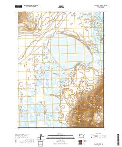
2020 Map of Flagstaff Lake
USGS Topo · Published 2020About this map
Flagstaff Lake and the interconnected wetlands of the Warner Valley dominate this high desert basin in southeastern Oregon. This remote landscape is characterized by a series of shallow alkali basins, including Mugwump Lake, Swamp Lake, and Anderson Lake, which shift in size and presence based on seasonal runoff. To the east, the dramatic rising slopes of Hart Mtn provide a stark vertical contrast to the valley floor, while the Rabbit Hills anchor the northwestern corner of the quadrangle. The sparse road network, consisting of Hart Mountain Rd and Flagstaff Lake Rd, highlights the isolation of this region. The map reveals the intricate drainage patterns of Mulkey Canyon and the surrounding plateau, offering a detailed record of the hydrography and terrain of Lake County in the early 21st century.
Find a feature on this map
17 named features on this map. Tap any name to fly to it.
Don’t see what you’re looking for? This feature index may not catch every label — zoom into the map to look around manually.
Map Details
Editions of this 2020 Flagstaff Lake Map
This is the sole edition of this map. No revisions or reprints were ever made.
Other maps of this area

1955 · Adel
USGS Topo · 1:250,000

1957 · Adel
USGS Topo · 1:250,000

1958 · Adel
USGS Topo · 1:250,000

1962 · Adel
USGS Topo · 1:250,000

1966 · Rabbit Hills NE
USGS Topo · 1:24,000

1966 · Rabbit Hills NW
USGS Topo · 1:24,000

1967 · Flagstaff Lake
USGS Topo · 1:24,000

1967 · Plush
USGS Topo · 1:24,000

1967 · Rabbit Hills SW
USGS Topo · 1:24,000

1967 · Campbell Lake
USGS Topo · 1:24,000