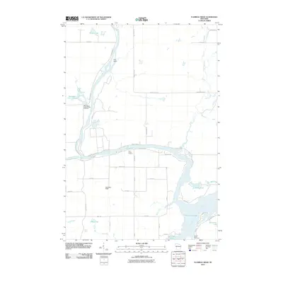
2010 Map of Flambeau Ridge
USGS Topo · Published 2010About this map
The confluence of the Chippewa River and the Flambeau River defines this northern Wisconsin landscape, where the waters merge near Pine Island before flowing south toward the Holcombe Flowage. The terrain is marked by the prominent elevation of the Flambeau Ridge and numerous tributaries including Deer Tail Creek, Taylor Creek, and the Jump River. Human presence is evidenced by a network of rural roads such as County Hwy-D and Sheep Camp Rd, which connect local landmarks like Saint Francis Cemetery and the Christian Harbor Youth Camp. Management of the local environment is highlighted by the Washington Creek Wildlife Area Dam, while the surrounding forest is dotted with smaller bodies of water like Bollman Lake and LaRose Lake. This survey captures the region's character as a hub for both water-based recreation and quiet rural life.
Find a feature on this map
43 named features on this map. Tap any name to fly to it.
Don’t see what you’re looking for? This feature index may not catch every label — zoom into the map to look around manually.
Map Details
Editions of this 2010 Flambeau Ridge Map
This is the sole edition of this map. No revisions or reprints were ever made.
Other maps of this area

1948 · Weyerhauser
USGS Topo · 1:48,000

1948 · Ladysmith
USGS Topo · 1:48,000

1949 · Bloomer
USGS Topo · 1:62,500

1950 · Weyerhauser
USGS Topo · 1:48,000

1950 · Ladysmith
USGS Topo · 1:48,000

1951 · Bloomer
USGS Topo · 1:62,500

1951 · Cornell
USGS Topo · 1:62,500

1953 · Rice Lake
USGS Topo · 1:250,000

1959 · Rice Lake
USGS Topo · 1:250,000
1971 · Ladysmith
USGS Topo · 1:24,000