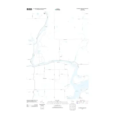
2013 Map of Flambeau Ridge
USGS Topo · Published 2013About this map
The Flambeau River and Chippewa River converge in this northern Wisconsin landscape, creating a complex hydrologic network of flowages and river bends. The prominent Flambeau Ridge rises above the lowlands, while the southern portion of the sheet is dominated by the extensive Holcombe Flowage 4700, where the Jump River enters from the east. This 2013 survey illustrates a region defined by recreational and seasonal settlements, including the Rivers Edge community and the Christian Harbor Youth Camp. Small lakes like LaRose Lake and Bollman Lake dot the wooded terrain, accessed by a grid of rural roads such as Sheep Camp Rd and Ranch Rd. The presence of the Washington Cr Flowage and numerous islands, notably Pine Island, underscores the importance of water management and timber history in Rusk County.
Find a feature on this map
50 named features on this map. Tap any name to fly to it.
Don’t see what you’re looking for? This feature index may not catch every label — zoom into the map to look around manually.
Map Details
Editions of this 2013 Flambeau Ridge Map
This is the sole edition of this map. No revisions or reprints were ever made.
Other maps of this area

1948 · Weyerhauser
USGS Topo · 1:48,000

1948 · Ladysmith
USGS Topo · 1:48,000

1949 · Bloomer
USGS Topo · 1:62,500

1950 · Weyerhauser
USGS Topo · 1:48,000

1950 · Ladysmith
USGS Topo · 1:48,000

1951 · Bloomer
USGS Topo · 1:62,500

1951 · Cornell
USGS Topo · 1:62,500

1953 · Rice Lake
USGS Topo · 1:250,000

1959 · Rice Lake
USGS Topo · 1:250,000
1971 · Ladysmith
USGS Topo · 1:24,000