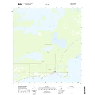
2018 Map of Flamingo
USGS Topo · Published 2018About this map
Everglades National Park encompasses this entire southern coastal reach, where the freshwater sawgrass of The Everglades meets the mangrove-lined saltwater of Florida Bay. The tiny settlement of Flamingo serves as a remote outpost at the terminus of Flamingo Rd, providing access to the vast network of internal waterways and coastal keys. Historically significant features like the Bear Lake Mound and the Homestead Canal offer evidence of human engineering and indigenous presence within this amphibious landscape.
Find a feature on this map
36 named features on this map. Tap any name to fly to it.
Don’t see what you’re looking for? This feature index may not catch every label — zoom into the map to look around manually.
Map Details
Editions of this 2018 Flamingo Map
This is the sole edition of this map. No revisions or reprints were ever made.
Other maps of this area

1956 · Miami
USGS Topo · 1:250,000

1958 · Miami
USGS Topo · 1:250,000

1972 · Whitewater Bay West
USGS Topo · 1:24,000

1972 · Whitewater Bay East
USGS Topo · 1:24,000

1972 · Mahogany Hammock
USGS Topo · 1:24,000

1972 · Lake Ingraham East
USGS Topo · 1:24,000

1972 · Pelican Keys
USGS Topo · 1:24,000

1972 · West Lake
USGS Topo · 1:24,000

1972 · Sandy Key
USGS Topo · 1:24,000

1972 · Clive Key
USGS Topo · 1:24,000