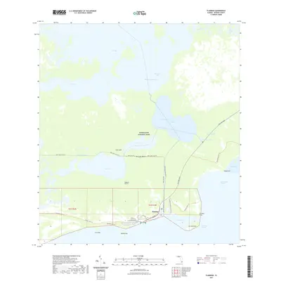
2021 Map of Flamingo
USGS Topo · Published 2021About this map
Flamingo sits at the southernmost edge of the Florida peninsula, serving as a vital outpost where the freshwater glades meet the saltwater of Florida Bay. This 2021 survey details a complex amphibious landscape within Everglades National Park, characterized by a network of historic water routes and modern trails. The Wilderness Waterway snakes through Whitewater Bay, while the Homestead Canal and Bear Lake Trl provide land-based access to the interior. Cultural and geographical markers like the Bear Lake Mound and Cape Sable indicate a long history of human interaction with this shifting environment. The map captures the infrastructure of the Flamingo Campground B-C Loop Road and Flamingo Lodge Highway, alongside isolated features like Joe Kemp Key and Roberts Prairie, illustrating the balance between public access and environmental preservation in this coastal wilderness.
Find a feature on this map
44 named features on this map. Tap any name to fly to it.
Don’t see what you’re looking for? This feature index may not catch every label — zoom into the map to look around manually.
Map Details
Editions of this 2021 Flamingo Map
This is the sole edition of this map. No revisions or reprints were ever made.
Other maps of this area

1956 · Miami
USGS Topo · 1:250,000

1958 · Miami
USGS Topo · 1:250,000

1972 · Whitewater Bay West
USGS Topo · 1:24,000

1972 · Whitewater Bay East
USGS Topo · 1:24,000

1972 · Mahogany Hammock
USGS Topo · 1:24,000

1972 · Lake Ingraham East
USGS Topo · 1:24,000

1972 · Pelican Keys
USGS Topo · 1:24,000

1972 · West Lake
USGS Topo · 1:24,000

1972 · Sandy Key
USGS Topo · 1:24,000

1972 · Clive Key
USGS Topo · 1:24,000