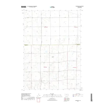
2017 Map of Flandreau NE
USGS Topo · Published 2017About this map
The Coteau des Prairies plateau dominates this section of the South Dakota landscape, characterized by the distinct glacial upland terrain that separates the Missouri and Mississippi river basins. The map illustrates a strictly organized agricultural grid across the boundary of Brookings and Moody counties, where section lines are traced by a network of rural roads such as 217th St and Co Hwy B. Drainage through these highlands is represented by the winding course of Spring Cr, which cuts through the otherwise geometric regularity of the township and range system. This 2017 survey reflects the persistent rural character of the region, documenting the modern infrastructure of the Coteau's prairie landscape.
Find a feature on this map
16 named features on this map. Tap any name to fly to it.
Don’t see what you’re looking for? This feature index may not catch every label — zoom into the map to look around manually.
Map Details
Editions of this 2017 Flandreau NE Map
This is the sole edition of this map. No revisions or reprints were ever made.
Other maps of this area

1953 · Watertown
USGS Topo · 1:250,000

1958 · Watertown
USGS Topo · 1:250,000

1964 · Flandreau SW
USGS Topo · 1:24,000

1964 · Flandreau NW
USGS Topo · 1:24,000

1964 · Aurora
USGS Topo · 1:24,000

1967 · Elkton SW
USGS Topo · 1:24,000

1967 · Lake Benton SW
USGS Topo · 1:24,000

1967 · Elkton
USGS Topo · 1:24,000

1972 · Flandreau NE
USGS Topo · 1:24,000
1972 · White SE
USGS Topo · 1:24,000
Featured Places
- Ward Township, SD
- Spring Creek Township, SD
- Elkton Township, SD
- Parnell Township, SD
- Brookings County, SD