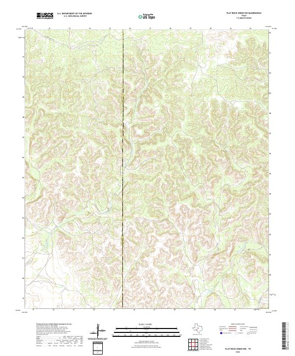
2022 Map of Flat Rock Creek NW
USGS Topo · Published 2022About this map
Val Verde and Edwards counties meet along a winding north-south boundary line on this 2022 survey of West Texas. The landscape is defined by the complex, branching drainage systems of the W Fork Sycamore Cr and Sycamore Cr, which carve deep into the plateau. Human influence is sparse, marked primarily by long-established ranching access points such as J S Murry Ranch Rd in the northwestern corner and Ranch Rd 2523 in the southeast. This contemporary topographic study highlights the persistent isolation of the region, where the terrain itself dictates the few available corridors for movement between the county lines.
Find a feature on this map
5 named features on this map. Tap any name to fly to it.
Don’t see what you’re looking for? This feature index may not catch every label — zoom into the map to look around manually.
Map Details
Editions of this 2022 Flat Rock Creek NW Map
This is the sole edition of this map. No revisions or reprints were ever made.
Other maps of this area

1943 · Carta Valley
USGS Topo · 1:62,500

1944 · Flat Rock
USGS Topo · 1:62,500

1944 · Dry Devil
USGS Topo · 1:62,500

1944 · Devils Lake
USGS Topo · 1:62,500

1958 · Del Rio
USGS Topo · 1:250,000

1964 · Del Rio
USGS Topo · 1:250,000

1972 · Miers Ranch
USGS Topo · 1:24,000

1972 · Rough Canyon SE
USGS Topo · 1:24,000
1978 · Carta Valley
USGS Topo · 1:24,000
1978 · Carta Valley SE
USGS Topo · 1:24,000