
1972 Map of Rough Canyon SE
USGS Topo · Published 1975About this map
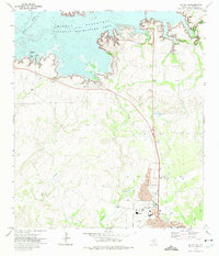
Amistad Res National Recreation Area occupies the southwestern corner of this 1970s survey, marking a period of transition for the Texas landscape as federal water management and recreation infrastructure took hold. The map illustrates a deeply dissected terrain defined by the winding drainages of San Pedro Creek and its North Fork San Pedro Creek, alongside the West Fork Sycamore Creek to the east.
Find a feature on this map
6 named features on this map. Tap any name to fly to it.
Don’t see what you’re looking for? This feature index may not catch every label — zoom into the map to look around manually.
Map Details
Editions of this 1972 Rough Canyon SE Map
This is the sole edition of this map. No revisions or reprints were ever made.
Other maps of this area

1941 · Standart
USGS Topo · 1:62,500

1943 · Standart
USGS Topo · 1:62,500

1943 · Del Rio
USGS Topo · 1:62,500

1944 · Flat Rock
USGS Topo · 1:62,500

1944 · Devils Lake
USGS Topo · 1:62,500

1958 · Del Rio
USGS Topo · 1:250,000

1964 · Del Rio
USGS Topo · 1:250,000

1972 · Miers Ranch
USGS Topo · 1:24,000
1972 · Del Rio NW
USGS Topo · 1:24,000
1972 · Del Rio NE
USGS Topo · 1:24,000