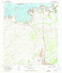
1972 Map of Del Rio NW
USGS Topo · Published 1975About this map
Amistad Reservoir and the Amistad National Recreation Area dominate the northern landscape of this 1970s survey, illustrating the significant impact of the damming of the Devils River on the border geography. The waters of the reservoir reach into numerous canyons, creating a complex shoreline near Lake View. Further south, the urban expansion of Del Rio and the settlement of Cantu are detailed with individual buildings, street names, and essential civic landmarks.
Find a feature on this map
34 named features on this map. Tap any name to fly to it.
Don’t see what you’re looking for? This feature index may not catch every label — zoom into the map to look around manually.
Map Details
Editions of this 1972 Del Rio NW Map
This is the sole edition of this map. No revisions or reprints were ever made.
Other maps of this area

1941 · Feely
USGS Topo · 1:62,500

1943 · Devils River
USGS Topo · 1:62,500

1943 · Del Rio
USGS Topo · 1:62,500

1944 · Devils River
USGS Topo · 1:62,500

1944 · Devils Lake
USGS Topo · 1:62,500

1958 · Del Rio
USGS Topo · 1:250,000

1964 · Del Rio
USGS Topo · 1:250,000

1972 · Amistad Dam
USGS Topo · 1:24,000

1972 · California Creek
USGS Topo · 1:24,000

1972 · Del Rio SW
USGS Topo · 1:24,000
Featured Places
- Del Rio, TX
- Lake View, TX
- Los Campos Number 3 and 4 Colonia, TX
- Los Campos Number 1,2 and 5 Colonia, TX
- Lake View Addition Colonia, TX