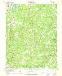
1968 Map of Flat Top
USGS Topo · Published 1972About this map
Shady Spring Mountain dominates the western landscape of this 1968 survey, where the West Virginia Turnpike cuts a modern path through the high ridges of Raleigh and Mercer Counties. The settlement of Flat Top sits at a critical junction near Huff Knob, serving as a high-elevation anchor for a region defined by steep drainage basins and scattered mountain communities. To the east, the terrain drops toward the Bluestone River and Bluestone Lake, where the newly established Pipestem State Park began to transform the local economy from traditional mountain farming toward recreation.
Find a feature on this map
48 named features on this map. Tap any name to fly to it.
Don’t see what you’re looking for? This feature index may not catch every label — zoom into the map to look around manually.
Map Details
Editions of this 1968 Flat Top Map
2 editions found
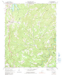
Other maps of this area

1887 · Pocahontas
USGS Topo · 1:125,000

1887 · Hinton
USGS Topo · 1:125,000

1890 · Dublin
USGS Topo · 1:125,000

1891 · Pocahontas
USGS Topo · 1:125,000

1891 · Dublin
USGS Topo · 1:125,000

1891 · Raleigh
USGS Topo · 1:125,000

1892 · Hinton
USGS Topo · 1:125,000

1894 · Pocahontas
USGS Topo · 1:125,000

1895 · Pocahontas
USGS Topo · 1:125,000

1897 · Raleigh
USGS Topo · 1:125,000