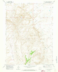
1970 Map of Flat Top Mountain
USGS Topo · Published 1973About this map
Flat Top Mountain dominates this portion of Carbon County, rising above a landscape defined by seasonal drainages and livestock routes. This 1970 field check documents a high-desert environment where water sources like Patterson Springs and the Pocket Reservoir were critical for regional ranching operations. The presence of the Shell Creek Stock Trail and Hangout Road indicates the continued importance of movement through the high country, connecting the various prongs of Red Creek and North Fork Cottonwood Creek. Scattered Drill Hole markings suggest early geological exploration or mineral assessment in the basins surrounding Hangout Ridge. This survey provides a clear view of the complex topography between North Flat Top and East Flat Top before modern development altered the remote terrain of southern Wyoming.
Find a feature on this map
19 named features on this map. Tap any name to fly to it.
Don’t see what you’re looking for? This feature index may not catch every label — zoom into the map to look around manually.
Map Details
Editions of this 1970 Flat Top Mountain Map
This is the sole edition of this map. No revisions or reprints were ever made.
Other maps of this area

1954 · Rawlins
USGS Topo · 1:250,000

1957 · Baggs
USGS Topo · 1:62,500

1957 · Doty Mountain
USGS Topo · 1:62,500

1958 · Rawlins
USGS Topo · 1:250,000

1962 · Rawlins
USGS Topo · 1:250,000

1967 · Rawlins
USGS Topo · 1:250,000

1970 · South Barrel Spring
USGS Topo · 1:24,000

1970 · Mexican Flats
USGS Topo · 1:24,000
1970 · Dripping Rock Spring
USGS Topo · 1:24,000
1970 · Mc Pherson Springs
USGS Topo · 1:24,000