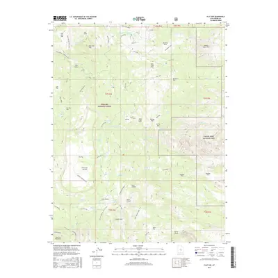
2017 Map of Flat Top
USGS Topo · Published 2017About this map
Fishlake National Forest and Capitol Reef National Park meet in this high-elevation landscape, where the geography is defined by prominent landmarks like Thousand Lake Mtn and Point Lookout. The terrain is marked by a complex system of drainages and ridges, including Deep Creek Ridge and Polk Creek Ridge, which separate various basins such as McDonld Basin and Sulphur Basin.
Find a feature on this map
73 named features on this map. Tap any name to fly to it.
Don’t see what you’re looking for? This feature index may not catch every label — zoom into the map to look around manually.
Map Details
Editions of this 2017 Flat Top Map
This is the sole edition of this map. No revisions or reprints were ever made.
Other maps of this area

1885 · Fish Lake
USGS Topo · 1:250,000

1896 · Fish Lake
USGS Topo · 1:250,000

1952 · Notom 2 NW
USGS Topo · 1:24,000

1952 · Loa 1 SE
USGS Topo · 1:24,000

1952 · Notom 2 SE
USGS Topo · 1:24,000

1952 · Notom 2 SW
USGS Topo · 1:24,000

1952 · Notom 2 NE
USGS Topo · 1:24,000

1952 · Torrey
USGS Topo · 1:62,500

1952 · Loa 1 NE
USGS Topo · 1:24,000

1956 · Salina
USGS Topo · 1:250,000