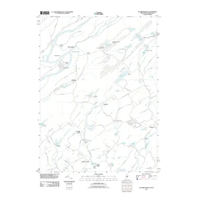
2011 Map of Flatbrookville
USGS Topo · Published 2011About this map
Wallpack Bend serves as the focal point of this landscape, where the Delaware River makes a sharp, dramatic turn around Sambo Island. This 2011 survey documents a corridor rich in recreational and historical sites, from the riverside Lower Wall Pack Cemetery near Flatbrookville to the numerous summer camps that dot the higher elevations. The terrain is defined by the steep ridges of the Blue Mountains, containing a series of water bodies such as Crater Lake and Lake Success that feed the Flat Brook and Blair Creek systems.
Find a feature on this map
122 named features on this map. Tap any name to fly to it.
Don’t see what you’re looking for? This feature index may not catch every label — zoom into the map to look around manually.
Map Details
Editions of this 2011 Flatbrookville Map
This is the sole edition of this map. No revisions or reprints were ever made.
Other maps of this area

1888 · Hackettstown
USGS Topo · 1:62,500

1891 · Wallpack
USGS Topo · 1:62,500

1891 · Delaware Water Gap
USGS Topo · 1:62,500

1893 · Delaware Water Gap
USGS Topo · 1:62,500

1893 · Wallpack
USGS Topo · 1:62,500

1894 · Hackettstown
USGS Topo · 1:62,500

1898 · Hackettstown
USGS Topo · 1:62,500

1900 · Raritan
USGS Topo · 1:125,000

1905 · Raritan
USGS Topo · 1:125,000

1905 · Hackettstown
USGS Topo · 1:62,500
Featured Places
- Blairstown, NJ
- Stillwater Township, NJ
- Fredon Township, NJ
- Hardwick Township, NJ
- Franklin Grove, Hardwick Township