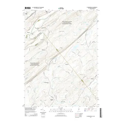
2014 Map of Flatbrookville
USGS Topo · Published 2014About this map
Wallpack Bend and Sambo Island define the sharp loop of the Delaware River at the western edge of this landscape, marking the historic boundary between New Jersey and Pennsylvania. Within the Delaware Water Gap National Recreation Area, the terrain rises from the river valley toward the prominent ridge of Kittatinny Mtn. The map preserves the layout of small, longstanding rural settlements such as Flatbrookville, Millbrook, and Hardwick Center, alongside traces of early regional history like the Lower Wall Pack Cem.
Find a feature on this map
105 named features on this map. Tap any name to fly to it.
Don’t see what you’re looking for? This feature index may not catch every label — zoom into the map to look around manually.
Map Details
Editions of this 2014 Flatbrookville Map
This is the sole edition of this map. No revisions or reprints were ever made.
Other maps of this area

1888 · Hackettstown
USGS Topo · 1:62,500

1891 · Wallpack
USGS Topo · 1:62,500

1891 · Delaware Water Gap
USGS Topo · 1:62,500

1893 · Delaware Water Gap
USGS Topo · 1:62,500

1893 · Wallpack
USGS Topo · 1:62,500

1894 · Hackettstown
USGS Topo · 1:62,500

1898 · Hackettstown
USGS Topo · 1:62,500

1900 · Raritan
USGS Topo · 1:125,000

1905 · Raritan
USGS Topo · 1:125,000

1905 · Hackettstown
USGS Topo · 1:62,500
Featured Places
- Blairstown, NJ
- Stillwater Township, NJ
- Fredon Township, NJ
- Hardwick Township, NJ
- Franklin Grove, Hardwick Township