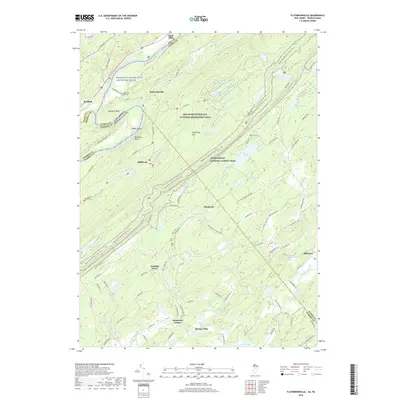
2019 Map of Flatbrookville
USGS Topo · Published 2019About this map
Flatbrookville and Millbrook sit within a landscape defined by the dramatic Wallpack Bend of the Delaware River. This area of New Jersey and Pennsylvania preserves a high density of water features, from the high elevation of Crater Lake and Lake Success atop Kittatinny Mtn to the many ponds like Catfish Pond and Sand Pond that dot the valley floor. The historical character of the region is anchored by the presence of the Lower Wall Pack Cem and the route of the Old Mine Rd, one of the oldest commercial roads in the United States. Tracing the Appalachian National Scenic Trail as it follows the ridge line, the map illustrates the boundary between the Delaware Water Gap National Recreation Area and localized settlements like Hardwick and Stillwater. The network of small brooks, including Flat Brook and Vancampens Brook, underscores the importance of the river drainage system to the development of early valley hamlets.
Find a feature on this map
116 named features on this map. Tap any name to fly to it.
Don’t see what you’re looking for? This feature index may not catch every label — zoom into the map to look around manually.
Map Details
Editions of this 2019 Flatbrookville Map
This is the sole edition of this map. No revisions or reprints were ever made.
Other maps of this area

1888 · Hackettstown
USGS Topo · 1:62,500

1891 · Wallpack
USGS Topo · 1:62,500

1891 · Delaware Water Gap
USGS Topo · 1:62,500

1893 · Delaware Water Gap
USGS Topo · 1:62,500

1893 · Wallpack
USGS Topo · 1:62,500

1894 · Hackettstown
USGS Topo · 1:62,500

1898 · Hackettstown
USGS Topo · 1:62,500

1900 · Raritan
USGS Topo · 1:125,000

1905 · Raritan
USGS Topo · 1:125,000

1905 · Hackettstown
USGS Topo · 1:62,500
Featured Places
- Blairstown, NJ
- Stillwater Township, NJ
- Fredon Township, NJ
- Hardwick Township, NJ
- Franklin Grove, Hardwick Township