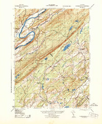
1943 Map of Flatbrookville
USGS Topo · Published 1943About this map
The Delaware River carves a dramatic path through the Kittatinny Mountains in this early 1940s survey of the New Jersey and Pennsylvania border. Along the river’s edge, the era of regional river crossings is preserved through Smiths Ferry, Rosencrans Ferry, and Deckers Ferry, serving settlements like Flatbrookville and Bushkill. The landscape is defined by the steep ridges of the mountains, punctuated by landmarks such as the Fire Lookout Tower and the Catfish Pond Gap.
Find a feature on this map
54 named features on this map. Tap any name to fly to it.
Don’t see what you’re looking for? This feature index may not catch every label — zoom into the map to look around manually.
Map Details
Editions of this 1943 Flatbrookville Map
This is the sole edition of this map. No revisions or reprints were ever made.
Other maps of this area

1888 · Hackettstown
USGS Topo · 1:62,500

1891 · Wallpack
USGS Topo · 1:62,500

1891 · Delaware Water Gap
USGS Topo · 1:62,500

1893 · Delaware Water Gap
USGS Topo · 1:62,500

1893 · Wallpack
USGS Topo · 1:62,500

1894 · Hackettstown
USGS Topo · 1:62,500

1898 · Hackettstown
USGS Topo · 1:62,500

1900 · Raritan
USGS Topo · 1:125,000

1905 · Raritan
USGS Topo · 1:125,000

1905 · Hackettstown
USGS Topo · 1:62,500
Featured Places
- Blairstown, NJ
- Stillwater Township, NJ
- Fredon Township, NJ
- Hardwick Township, NJ
- Flatbrookville, Walpack Township