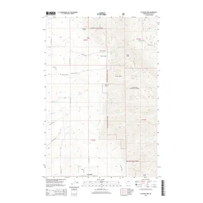
2014 Map of Flathead Pass
USGS Topo · Published 2014About this map
Springhill sits at the base of the dramatic Bridger Range, serving as a focal point for a landscape defined by sharp elevation changes and deep drainage basins. This 2014 survey captures the complex topography of the Gallatin National Forest, where the transition from valley floor to high mountain passes is marked by numerous family-named landmarks and historical access routes. The map documents a network of primitive roads and trails, such as Haugland Ranch Rd and Flathead Pass Rd, which navigate through Morrison Canyon and Mill Creek Canyon.
Find a feature on this map
43 named features on this map. Tap any name to fly to it.
Don’t see what you’re looking for? This feature index may not catch every label — zoom into the map to look around manually.
Map Details
Editions of this 2014 Flathead Pass Map
This is the sole edition of this map. No revisions or reprints were ever made.
Other maps of this area

1886 · Fort Logan
USGS Topo · 1:250,000

1886 · Little Belt Mts.
USGS Topo · 1:250,000

1888 · Three Forks
USGS Topo · 1:250,000

1891 · Livingston
USGS Topo · 1:250,000

1893 · Livingston
USGS Topo · 1:250,000

1894 · Three Forks
USGS Topo · 1:250,000

1894 · Little Belt Mts.
USGS Topo · 1:250,000

1895 · Three Forks
USGS Topo · 1:250,000

1897 · Little Belt Mts.
USGS Topo · 1:250,000

1898 · Little Belt Mts.
USGS Topo · 1:250,000