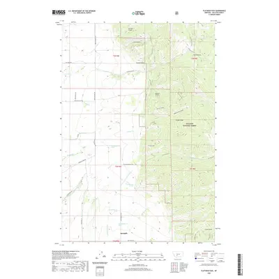
2020 Map of Flathead Pass
USGS Topo · Published 2020About this map
Springhill sits at the base of the Bridger Range, where the high elevations of the Gallatin National Forest drop into the fertile valley floor of Gallatin County. This landscape is defined by the sharp transition from steep alpine terrain to a network of creeks and springs. Drainage from the mountains flows through deeply incised features like Mill Creek Canyon and Felix Canyon, eventually feeding into Pass Cr and the complex system around Reese Cr.
Find a feature on this map
42 named features on this map. Tap any name to fly to it.
Don’t see what you’re looking for? This feature index may not catch every label — zoom into the map to look around manually.
Map Details
Editions of this 2020 Flathead Pass Map
This is the sole edition of this map. No revisions or reprints were ever made.
Other maps of this area

1886 · Fort Logan
USGS Topo · 1:250,000

1886 · Little Belt Mts.
USGS Topo · 1:250,000

1888 · Three Forks
USGS Topo · 1:250,000

1891 · Livingston
USGS Topo · 1:250,000

1893 · Livingston
USGS Topo · 1:250,000

1894 · Three Forks
USGS Topo · 1:250,000

1894 · Little Belt Mts.
USGS Topo · 1:250,000

1895 · Three Forks
USGS Topo · 1:250,000

1897 · Little Belt Mts.
USGS Topo · 1:250,000

1898 · Little Belt Mts.
USGS Topo · 1:250,000