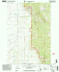
2000 Map of Flathead Pass
USGS Topo · Published 2005About this map
Flathead Pass serves as a critical geographic marker in this section of the Gallatin National Forest, where the terrain transitions from the western agricultural drainages into the high canyons of the Bridger Range. This 2000 revision reveals a landscape shaped by both resource extraction and water management, evidenced by a Mine Shaft and multiple Prospect sites along Mill Creek. The western portion of the map is defined by an intricate network of drainages including Cottonwood Creek and Pass Creek, supported by a labeled Ditch system that suggests historic irrigation practices for the lower ranch lands.
Find a feature on this map
30 named features on this map. Tap any name to fly to it.
Don’t see what you’re looking for? This feature index may not catch every label — zoom into the map to look around manually.
Map Details
Editions of this 2000 Flathead Pass Map
This is the sole edition of this map. No revisions or reprints were ever made.
Other maps of this area

1886 · Fort Logan
USGS Topo · 1:250,000

1886 · Little Belt Mts.
USGS Topo · 1:250,000

1888 · Three Forks
USGS Topo · 1:250,000

1891 · Livingston
USGS Topo · 1:250,000

1893 · Livingston
USGS Topo · 1:250,000

1894 · Three Forks
USGS Topo · 1:250,000

1894 · Little Belt Mts.
USGS Topo · 1:250,000

1895 · Three Forks
USGS Topo · 1:250,000

1897 · Little Belt Mts.
USGS Topo · 1:250,000

1898 · Little Belt Mts.
USGS Topo · 1:250,000