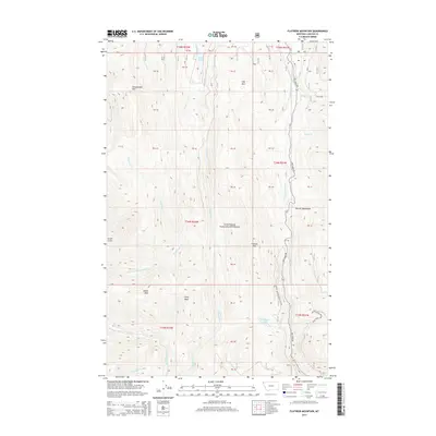
2014 Map of Flatiron Mountain
USGS Topo · Published 2014About this map
Kootenai National Forest dominates this section of Lincoln County, characterized by the high elevations of the Purcell Mountains. The landscape is defined by a series of prominent summits, including Flatiron Mtn, Sheepherder Mtn, and the distinctive Indian Peak. This drainage network is complex, with the S Fork Yaak River and Pipe Cr carving through the terrain. Small alpine water bodies like Lake Rene and Rainbow Lake are tucked between the ridges. The presence of Pipe Creek Rd and several Forest Development Roads indicates the infrastructure used for land management and access within the national forest. Numerous named drainages such as Flattail Cr and Seventeenmile Cr illustrate the watershed patterns typical of this mountainous region of Northwest Montana.
Find a feature on this map
43 named features on this map. Tap any name to fly to it.
Don’t see what you’re looking for? This feature index may not catch every label — zoom into the map to look around manually.
Map Details
Editions of this 2014 Flatiron Mountain Map
This is the sole edition of this map. No revisions or reprints were ever made.
Other maps of this area

1957 · Kalispell
USGS Topo · 1:250,000

1960 · Kalispell
USGS Topo · 1:250,000

1961 · Kalispell
USGS Topo · 1:250,000

1963 · Yaak
USGS Topo · 1:24,000

1963 · Turner Mountain
USGS Topo · 1:24,000

1963 · Sylvanite
USGS Topo · 1:24,000

1963 · Pulpit Mountain
USGS Topo · 1:24,000

1963 · Pink Mountain
USGS Topo · 1:24,000

1963 · Clark Mountain
USGS Topo · 1:24,000
1963 · Flatiron Mountain
USGS Topo · 1:24,000