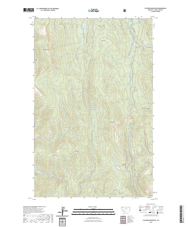
2024 Map of Flatiron Mountain
USGS Topo · Published 2024About this map
Kootenai National Forest dominates this section of Lincoln County, defined by a series of high ridges and narrow drainage basins in the northwest corner of the state. The landscape is anchored by massive peaks like Flatiron Mtn, Indian Peak, and Shepherder Mtn, which separate the headwaters of numerous mountain streams. Hydrological patterns are central to the area's layout, with Rainbow Lake and Lake Rene providing small alpine water bodies tucked between high-elevation contours. The drainage network is dense, featuring the South Fork Yaak River and Pipe Creek, which flow through deep valleys alongside Clay Creek and Flattail Creek. Evidence of backcountry travel and forest management is visible through a system of trails and service roads, including the Flatiron Ridge Trl and the Pleasant View/Shepherder Trl, which navigate the steep terrain between the Purcell Mountains and the surrounding wilderness.
Find a feature on this map
44 named features on this map. Tap any name to fly to it.
Don’t see what you’re looking for? This feature index may not catch every label — zoom into the map to look around manually.
Map Details
Editions of this 2024 Flatiron Mountain Map
This is the sole edition of this map. No revisions or reprints were ever made.
Other maps of this area

1957 · Kalispell
USGS Topo · 1:250,000

1960 · Kalispell
USGS Topo · 1:250,000

1961 · Kalispell
USGS Topo · 1:250,000

1963 · Yaak
USGS Topo · 1:24,000

1963 · Turner Mountain
USGS Topo · 1:24,000

1963 · Sylvanite
USGS Topo · 1:24,000

1963 · Pulpit Mountain
USGS Topo · 1:24,000

1963 · Pink Mountain
USGS Topo · 1:24,000

1963 · Clark Mountain
USGS Topo · 1:24,000
1963 · Flatiron Mountain
USGS Topo · 1:24,000