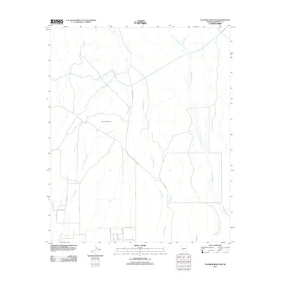
2011 Map of Flatiron Mountain
USGS Topo · Published 2011About this map
Flatiron Mountain stands as the central topographic landmark in this arid landscape west of Phoenix, where seasonal drainage systems define the movement of water and the layout of early infrastructure. The map illustrates a network of ephemeral watercourses, including Fourmile Wash, Phillips Wash, and the extensive Jackrabbit Wash, which carve through the desert floor. These natural features are interspersed with isolated water points such as Jones Tank and South Tank, essential markers for land management in this dry environment.
Find a feature on this map
21 named features on this map. Tap any name to fly to it.
Don’t see what you’re looking for? This feature index may not catch every label — zoom into the map to look around manually.
Map Details
Editions of this 2011 Flatiron Mountain Map
This is the sole edition of this map. No revisions or reprints were ever made.
Other maps of this area

1954 · Phoenix
USGS Topo · 1:250,000

1957 · Phoenix
USGS Topo · 1:250,000

1957 · White Tank Mts.
USGS Topo · 1:62,500

1958 · Phoenix
USGS Topo · 1:250,000

1958 · Buckeye NW
USGS Topo · 1:24,000

1958 · Buckeye
USGS Topo · 1:62,500

1960 · Phoenix
USGS Topo · 1:250,000

1962 · Belmont Mts
USGS Topo · 1:62,500

1962 · Arlington
USGS Topo · 1:62,500

1969 · Phoenix
USGS Topo · 1:250,000