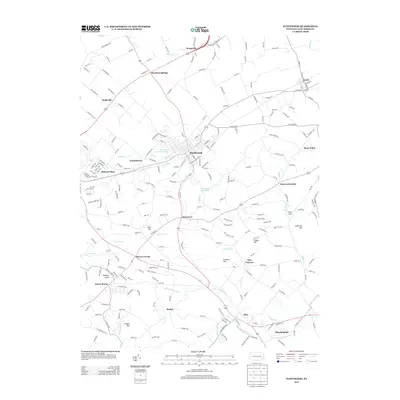
2013 Map of Fleetwood
USGS Topo · Published 2013About this map
Oley Furnace and the industrial remnants along Furnace Cr anchor this portion of Berks County, where the transition from colonial-era manufacturing to modern residential life is clearly visible. The landscape is defined by its small crossroads settlements and the winding paths of Little Manatawny Cr and Moselem Cr. Numerous family-named hills, such as Sheep Hill and Andstadt Hill, rise above the valley floor, overlooking established communities like Fleetwood and Lyons. Significant infrastructure like the Fleetwood Reservoir and the Fleetwood Community Pool highlight the area's local development, while named locales such as Charmingdale, Breezy Corner, and Boyers Junction represent the small hubs that have connected these agricultural and industrial lands for generations. This survey provides a precise look at the township’s network of rural roads and watercourses before further suburban expansion.
Find a feature on this map
224 named features on this map. Tap any name to fly to it.
Don’t see what you’re looking for? This feature index may not catch every label — zoom into the map to look around manually.
Map Details
Editions of this 2013 Fleetwood Map
This is the sole edition of this map. No revisions or reprints were ever made.
Other maps of this area

1894 · Reading
USGS Topo · 1:62,500

1902 · Boyertown
USGS Topo · 1:62,500

1902 · Slatington
USGS Topo · 1:62,500

1909 · Hamburg
USGS Topo · 1:62,500

1911 · Hamburg
USGS Topo · 1:62,500

1913 · Reading
USGS Topo · 1:62,500

1915 · Reading
USGS Topo · 1:62,500

1937 · Allentown West
USGS Topo · 1:48,000

1942 · Allentown West
USGS Topo · 1:62,500

1943 · Manatawny
USGS Topo · 1:31,680