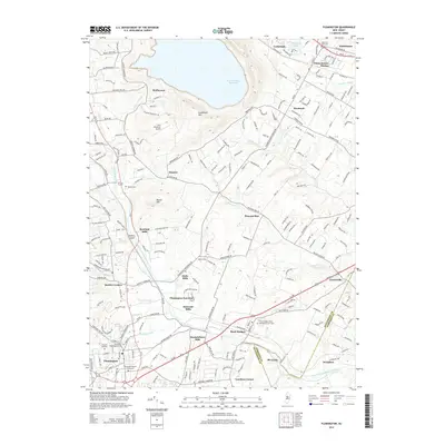
2014 Map of Flemington
USGS Topo · Published 2014About this map
The South Branch Raritan River anchors this landscape, winding through a corridor of historic milling sites and small settlements. The river's influence is evident in the cluster of locations such as Rowland Mills, Darts Mills, Holcomb Mills, and Rockefellows Mills, reflecting an early industrial network driven by water power. To the north, the massive Round Valley Reservoir and the prominent ridge of Cushetunk Mtn define the topography, while Herr Mountain Airport sits tucked between the ridges.
Find a feature on this map
45 named features on this map. Tap any name to fly to it.
Don’t see what you’re looking for? This feature index may not catch every label — zoom into the map to look around manually.
Map Details
Editions of this 2014 Flemington Map
This is the sole edition of this map. No revisions or reprints were ever made.
Other maps of this area

1888 · Princeton
USGS Topo · 1:62,500

1890 · High Bridge
USGS Topo · 1:62,500

1890 · Lambertville
USGS Topo · 1:62,500

1891 · Somerville
USGS Topo · 1:62,500

1891 · Lambertville
USGS Topo · 1:62,500

1893 · Somerville
USGS Topo · 1:62,500

1894 · Princeton
USGS Topo · 1:62,500

1894 · Lambertville
USGS Topo · 1:62,500

1898 · High Bridge
USGS Topo · 1:62,500

1898 · Somerville
USGS Topo · 1:62,500
Featured Places
- Hillsborough Township, NJ
- Raritan Township, NJ
- Readington Township, NJ
- Flemington, NJ
- Branchburg Township, NJ