
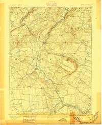
1890 Map of High Bridge
USGS Topo · Published 1890About this map
The South Branch of Raritan River carves a central path through this late-nineteenth-century landscape, serving as a corridor for both water and rail. The town of High Bridge sits at a critical junction where the High Bridge Branch Central Railroad of New Jersey splits to serve the northern valleys. The topography is dominated by the dramatic horseshoe curve of Cushetunk Mountain and Round Valley Mountain, which encircle a basin that would later become a major reservoir.
Find a feature on this map
92 named features on this map. Tap any name to fly to it.
Don’t see what you’re looking for? This feature index may not catch every label — zoom into the map to look around manually.
Map Details
Editions of this 1890 High Bridge Map
2 editions found
Other maps of this area

1888 · Hackettstown
USGS Topo · 1:62,500

1888 · Princeton
USGS Topo · 1:62,500

1888 · Lake Hopatcong
USGS Topo · 1:62,500

1890 · Easton
USGS Topo · 1:62,500

1890 · Lambertville
USGS Topo · 1:62,500

1890 · Doylestown
USGS Topo · 1:62,500

1891 · Somerville
USGS Topo · 1:62,500

1891 · Easton
USGS Topo · 1:62,500

1891 · Lambertville
USGS Topo · 1:62,500

1891 · Doylestown
USGS Topo · 1:62,500