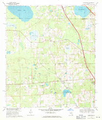
1969 Map of Flemington
USGS Topo · Published 1971About this map
Flemington and Irvine anchor this North Central Florida landscape during the late 1960s, a region defined by its numerous prairie depressions and interconnected ponds. The Arredondo Grant Boundary cuts across the center of the sheet, reflecting the area's early land grant history. Rural life is centered around local congregations and burial grounds, including Shiloh Ch, Shiloh Cem, and Greater New Bethel Ch.
Find a feature on this map
31 named features on this map. Tap any name to fly to it.
Don’t see what you’re looking for? This feature index may not catch every label — zoom into the map to look around manually.
Map Details
Editions of this 1969 Flemington Map
2 editions found
Other maps of this area

1890 · Arredondo
USGS Topo · 1:62,500

1892 · Arredondo
USGS Topo · 1:62,500

1893 · Citra
USGS Topo · 1:62,500

1894 · Arredondo
USGS Topo · 1:62,500

1895 · Williston
USGS Topo · 1:62,500

1895 · Citra
USGS Topo · 1:62,500

1938 · Hawthorn
USGS Topo · 1:48,000

1943 · Hawthorn
USGS Topo · 1:62,500

1954 · Gainesville
USGS Topo · 1:250,000

1958 · Gainesville
USGS Topo · 1:250,000