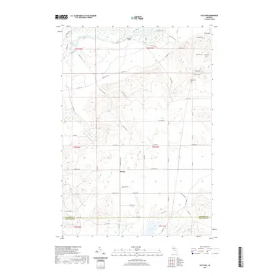
2019 Map of Fletcher
USGS Topo · Published 2019About this map
Fletcher sits at the heart of this landscape, marking a localized node of settlement amidst the glacial terrain and water systems of Northern Michigan. The northern boundary is defined by the Manistee River, which flows past the King Trout Airport and is fed by tributaries like Clear Cr. Further south, the map details the marshy surroundings of Grass Lake and the winding course of Big Cannon Cr. The topography is characterized by a series of distinct elevations in the northeast corner, including Waldo Hill, Richards Hill, and Smith Hill, which rise above the surrounding plains. The local road network, including the diagonal path of Military Rd and the straight sections of Fletcher Rd SE, illustrates the intersection of historical transit routes and the Public Land Survey System. This survey documents the boundary between Kalkaska Co and Missaukee Co, providing a clear look at the late 2010s parceling of this timbered and water-rich region.
Find a feature on this map
58 named features on this map. Tap any name to fly to it.
Don’t see what you’re looking for? This feature index may not catch every label — zoom into the map to look around manually.
Map Details
Editions of this 2019 Fletcher Map
This is the sole edition of this map. No revisions or reprints were ever made.
Other maps of this area

1949 · Black Creek
USGS Topo · 1:24,000

1949 · Fletcher
USGS Topo · 1:62,500

1950 · Cote Dame Marie
USGS Topo · 1:24,000

1950 · Fletcher
USGS Topo · 1:24,000

1950 · Lake Margrethe
USGS Topo · 1:24,000

1954 · Traverse City
USGS Topo · 1:250,000

1956 · Kalkaska
USGS Topo · 1:62,500

1956 · Houghton Lake
USGS Topo · 1:62,500

1956 · Lake City
USGS Topo · 1:62,500

1958 · Traverse City
USGS Topo · 1:250,000