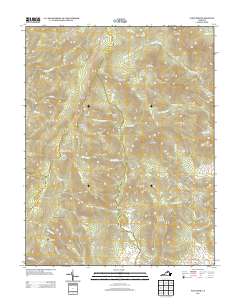
2013 Map of Fletcher
USGS Topo · Published 2013About this map
Shenandoah National Park defines the western half of this map, where the high ridges of the Blue Ridge Mountains are traversed by the winding Skyline Dr. This mountain corridor features numerous historic recreation sites, including Rapidan Camp, once a presidential retreat, and several hiker accommodations such as Pocosin Cabin and the Bearfence Mountain Shelter. The landscape is marked by dramatic terrain like Huckleberry Cliff and Bear Church Rock, which overlook the headwaters of the Rapidan River and Conway River.
Find a feature on this map
89 named features on this map. Tap any name to fly to it.
Don’t see what you’re looking for? This feature index may not catch every label — zoom into the map to look around manually.
Map Details
Editions of this 2013 Fletcher Map
This is the sole edition of this map. No revisions or reprints were ever made.
Other maps of this area

1892 · Woodstock
USGS Topo · 1:125,000

1892 · Gordonsville
USGS Topo · 1:125,000

1892 · Harrisonburg
USGS Topo · 1:125,000

1893 · Luray
USGS Topo · 1:125,000

1905 · Luray
USGS Topo · 1:125,000

1929 · Stony Man
USGS Topo · 1:48,000

1930 · Madison
USGS Topo · 1:48,000

1933 · Stony Man
USGS Topo · 1:62,500

1933 · Madison
USGS Topo · 1:62,500

1937 · Elkton
USGS Topo · 1:62,500